Hiking & Climbing
Want to get to know Northern New Mexico? Use your feet! Within an hour of Taos are more than fifty hiking trails in the mountains and foothills, and along the canyon of the Rio Grande. View online maps (trails.com) and trail ratings, and stop by the Carson National Forest Office and Rio Grande Visitor Center to get oriented. And by all means, ask the experienced folks at Taos Mountain Outfitters on the Plaza and Mudd N Flood on Bent Street for recommendations and advice. In Taos Ski Valley it's the people at Northside. Locals know!
While you're there, ask the folks at Mudd N Flood for rock climbing spots and safety precautions. The Pilar area offers bouldering all year. Mountain Skills New Mexico rock climbing guides and instructors are available in Taos.
Every calculation based on experience elsewhere, fails in New Mexico.
Lew Wallace, Governor of the New Mexico territory, 1878 - 1881
Wallace’s words may be doubly true for Taos. Climbing is dangerous and unpredictable here due to the high elevation, with sudden changes in weather conditions and temperature. Snow can remain through summer on north facing slopes, causing wet, slippery, and muddy spots. Use guides and good judgment, and ask for advice.
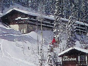
Hiking in Taos Ski Valley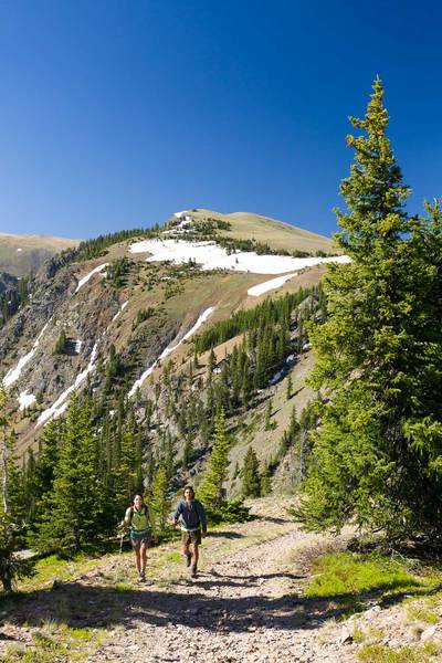
Columbine-Hondo Wilderness Study Area (WSA)
MODERATE TO STRENUOUS
Located between the Latir Peak and Wheeler Peak Wildernesses, the Columbine–Hondo Wilderness Study Area offers an extensive and well-developed system, with approximately 75 miles of trails. Some of the best hikes begin at trailheads found in Hondo Canyon along the winding mountain road (NM 150) to Taos Ski Valley.
Yerba Canyon and Manzanita Canyon
EASY TO MODERATE
This is a great loop trail up through lush alpine scenery to Lobo Peak. With all the stream crossings and greenery, you’ll find it hard to believe you are in New Mexico with the high desert of Taos just a few miles down the road. This loop starts about 10 miles up the Ski Valley road from the intersection with NM 522 north of Taos. Trailhead sign on your right. View trail head on Google Maps.
Italianos and Gavilan
MODERATE TO STRENUOUS
One of the most scenic of the trails in the Taos area, Italianos is a favorite of locals. The trail is 3.6 miles long climbing from 8,704 to 11,387 feet at its intersection with the Lobo Peak Trail. Italianos has numerous water crossings that have been improved with rocks or logs for easy stepping. Can be soggy. Wonderful wildflowers and vegetation all along the way. For a loop, take Gavilan trail back down. Gavilan Trail begins near Amizette and passes old mining pits before making a gradual and then steep climb through aspen stands and alpine meadows to the intersection with the Columbine-Twining Recreation Trail at the saddle. From here you can hike the ridgeline, or take the Columbine trail down into Red River canyon. View trail head on Google Maps.
Bull of the Woods and Wheeler Peak
MODERATE to STRENUOUS
One of the best-known hikes in New Mexico is the 14-mile Bull of the Woods and Wheeler Peak trail, which offers spectacular diversity of scenery. Well-fitted boots are highly recommended, along with an early morning departure time. For a much shorter but still challenging hike that gains in elevation, stop in the Bull of Woods (BOW) pasture for a snack and then head back down (4 miles, round trip). Or, from BOW take the trail to Gold Hill for a spectacular view, or go over BOW mountain to exit on the East Fork of the Red River. BOW trailhead is located in the Taos Ski Valley Parking Lot. View trail head on Google Maps.
Williams Lake and Wheeler Peak
MODERATE to STRENUOUS
A gorgeous hike in the Wheeler Peak Wilderness Area! Even though there is elevation gain up to the lake, the trail is relatively easy. It is a popular trail for snowshoers and dogs and their owners, and can get busy in all seasons. If you are in good shape and want even more spectacular views, go the additional 1.4 miles from the east side of the lake up the steep switchbacks through the boulder field to the 13,161 ft summit of Wheeler Peak. Caution: Some steep and sometimes slippery spots. Williams Lake Trail begins near the Phoenix Grill at Taos Ski Valley. View Wheeler Peak on Google Maps. Then, view Williams Lake on Google Maps.
Visit Taos Ski Valley Chamber of Commerce for more inforamtion.
Hiking Near Town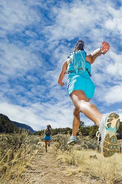
Devisadero Loop
MODERATE
This is a great in-town hike with spectacular views of Taos Mountain, Wheeler Peak and Taos Pueblo lands. Fun switchbacks, pinon, prickly pear, pine and spruce all around. Best time to hike this trail is Spring or Fall. If you go in Summer, try to get out early before the heat of the day kicks in. The trailhead is 2.8 miles up US 64 from the intersection of 64 and NM 68.View trail head on Google Maps.
Hiking Out of Town
Wild Rivers Recreation Area near Questa
EASY TO MODERATE
Enjoy the unique scenery where the Rio Grande and the Red River meet. A beautiful canyon with nice hikes down to the river and petroglyphs (ancient rock art) scattered around. Quiet and good for riverside camping. About 45 minutes to 1 hour from Taos. View trail head on Google Maps.
If you are really hardcore you might try Williams Lake in the morning (Taos Ski Valley), and then Wild Rivers in the afternoon. Williams Lake is 2.4 miles from the trailhead, and you go from 10,200' to 11,100' in elevation. At the Wild Rivers Gorges. Then hike down the 1.2 mile trail with its 800' change in elevation. Two great hikes in two completely different environments in just one day! From tripadvisor.com
Red River
Columbine-Hondo Wilderness Study Area (WSA)
EASY TO MODERATE
The Columbine–Hondo Wilderness Study Area lies between Hondo Canyon and Red River Canon, with trails access on NM 38 and NM 578. One of the best hikes is the Columbine Trail, which is relatively easy as it follows the creek for several miles. For a more challenging trek, take the trail all the way to the summt. Plenty of hiking close to the town of Red River, with lots of trails that go to old mine sites and beautiful valleys and lakes. You can even reach Wheeler Peak in the Taos Ski Valley from here. There are hundreds of other trails throughout the Enchanted Circle area. Visit Carson National Forest for more detailed information.
Valle Vidal
MODERATE
Near Costilla, north on Highway 522 on the Colorado border, Valle Vidal has lots of hiking ground and has a beautiful valley untouched by humans. About 2 hours from Taos, and an excellent drive to view fall colors. All-wheel drive suggested for the gravel road, not open for winter travel. View Valle Vidal on Google Maps.
Tip: Good fly fishing on the Costilla and Comanche Creeks.
Photos by Michael DeYoung.